
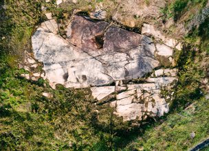
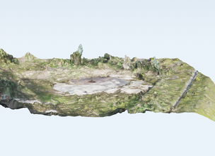
The Monte de São Silvestre was populated from Recent Prehistory, when, at the base of its slope, this megalithic sepulchral monument was built, according to oral tradition.
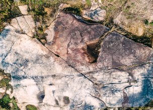
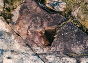
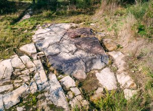
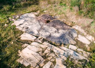
A set of eleven granitic outcrops with rupestrian engravings were inventoried and studied, distributed over the east and east-southeast slopes of the mountain. These were designated by the toponym Breia. Breia is composed by a set of three horizontal outcrops and not very noticeable from the ground, located along a small valley, existing at the base of the eastern slope of Monte de S. Silvestre. There runs a water line that flows into the Nogueira River, one of the tributaries on the right bank of Lima. It is a place of natural window between the lands of the bottom of the valley and those of altitude, having been a traditional grazing area.
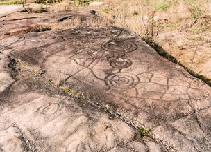
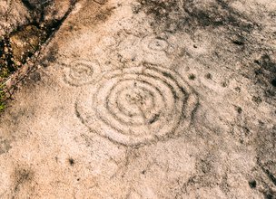
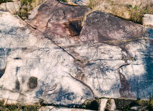
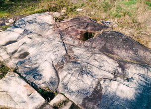
The outcrop is profusely recorded with Atlantic Art and other motifs from different chronologies having been divided into 7 different panels.
In general, the engravings are characterized by circular figures accompanied in certain places by semi-naturalist figures, with representation of the limbs in movement and the tail raised, for what appears to be an equine.
The Monte de São Silvestre was populated from Recent Prehistory, when, at the base of its slope, this megalithic sepulchral monument was built, according to oral tradition.
A set of eleven granitic outcrops with rupestrian engravings were inventoried and studied, distributed over the east and east-southeast slopes of the mountain. These were designated by the toponym Breia. Breia is composed by a set of three horizontal outcrops and not very noticeable from the ground, located along a small valley, existing at the base of the eastern slope of Monte de S. Silvestre. There runs a water line that flows into the Nogueira River, one of the tributaries on the right bank of Lima. It is a place of natural window between the lands of the bottom of the valley and those of altitude, having been a traditional grazing area.
The outcrop is profusely recorded with Atlantic Art and other motifs from different chronologies having been divided into 7 different panels.
In general, the engravings are characterized by circular figures accompanied in certain places by semi-naturalist figures, with representation of the limbs in movement and the tail raised, for what appears to be an equine.

Location
S. Silvestre hill, Cardielos
Coordinates
Lat: 41.7217361
Long: -8.7333139
 Theme
Theme
 Point of interest


Hello little one!
I'm Piquinhos and I can help you learn more about the Geopark!

Technical details
Child Mode
Discover the geopark in a simpler format, aimed at the little ones.
Clique ENTER para pesquisar ou ESC para sair