
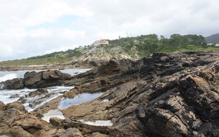
Evolution of coastal platforms and climate cycles
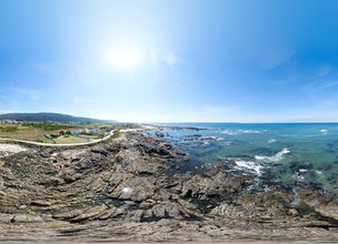
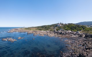
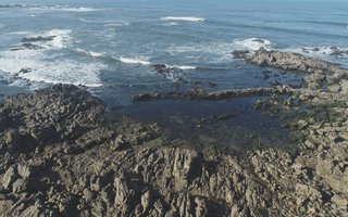
The Cemetery of Ancient beaches of Alcantilado de Montedor Local Natural Monument is the most diversified in terms of preserved geomorphic interests, in particular residual, tectonic and coastal interests. Fluvial, aeolis, periglacial and geocultural interests were also identified.
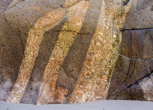
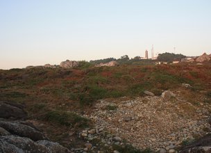
The Montedor’s hill constitutes an interval of the coastal platform, geologically explained by the west magma extravasating from Bouça de Frade's main plutonite body, in direction of the current ocean.
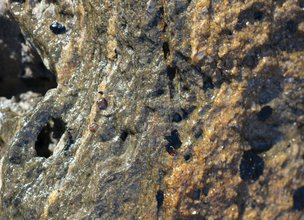
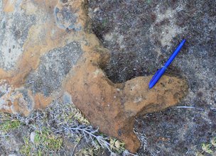
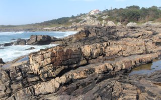
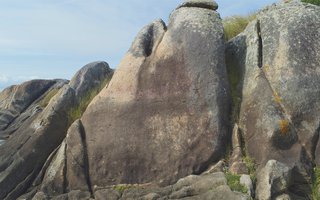
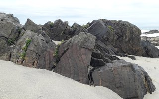
The Rheic’s rock erosion, which surrounded the magmatic chambers (plutonites), and the uprising processes, that the territory suffered since the end of the Mesozoic era (Alpine orogeny), revealed to the surface the Palaeozoic origins of this territory. The heat transfer and the space that plutonites won over Rheic’s rocks, as well the geometry of the Palaeozoic super continents collision (oblique and diachronic collision) might be interpreted as geological aspects of great interest and beauty, like the thrust fault, the folding or the mineralogical assembly, that today we can contemplate, for example, in Montedor.
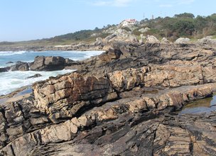
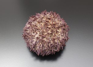
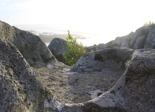
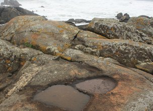
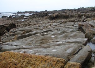
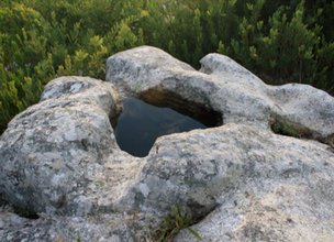
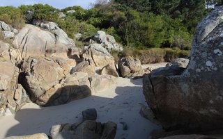
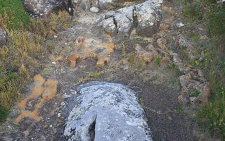
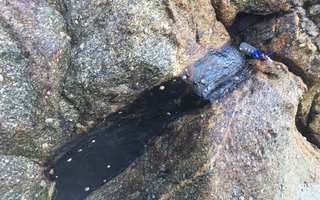
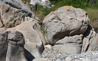
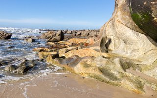
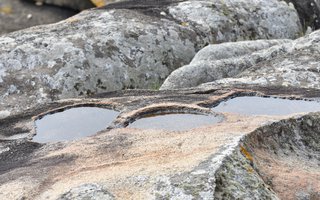
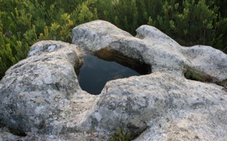
Therefore, these are the materials and structures of Palaeozoic heritage, that interacting with external geodynamic processes (coastal and climatic ones), control the quaternary geology and geomorphology. In this context and in a large scale analysis, the existence of outcropping granitic coastal platforms, allows us to know the altimetry of 5 ancient beach’s levels (coastal platforms) preserved above the actual (<1.8 meters): Platform I (18 m), Platform II (13 m), Platform III (8 m), Platform IV (4.5-5.5 m) and Platform V (2.0-3.5 m). Some of these platforms still preserve some ancient biological activity remains such as urchin’s alveoli (ichnofossils) and other records of the beach dynamics, in the form of notches and fossilized dune fields.
Bibliography
Carvalhido, Ricardo (2012). O Litoral Norte de Portugal (Minho-Neiva): evolução paleoambiental quaternária e proposta de conservação do património geomorfológico. Tese de Doutoramento. Universidade do Minho. 562 p.
The Cemetery of Ancient beaches of Alcantilado de Montedor Local Natural Monument is the most diversified in terms of preserved geomorphic interests, in particular residual, tectonic and coastal interests. Fluvial, aeolis, periglacial and geocultural interests were also identified.
The Montedor’s hill constitutes an interval of the coastal platform, geologically explained by the west magma extravasating from Bouça de Frade's main plutonite body, in direction of the current ocean.
The Rheic’s rock erosion, which surrounded the magmatic chambers (plutonites), and the uprising processes, that the territory suffered since the end of the Mesozoic era (Alpine orogeny), revealed to the surface the Palaeozoic origins of this territory. The heat transfer and the space that plutonites won over Rheic’s rocks, as well the geometry of the Palaeozoic super continents collision (oblique and diachronic collision) might be interpreted as geological aspects of great interest and beauty, like the thrust fault, the folding or the mineralogical assembly, that today we can contemplate, for example, in Montedor.
Therefore, these are the materials and structures of Palaeozoic heritage, that interacting with external geodynamic processes (coastal and climatic ones), control the quaternary geology and geomorphology. In this context and in a large scale analysis, the existence of outcropping granitic coastal platforms, allows us to know the altimetry of 5 ancient beach’s levels (coastal platforms) preserved above the actual (<1.8 meters): Platform I (18 m), Platform II (13 m), Platform III (8 m), Platform IV (4.5-5.5 m) and Platform V (2.0-3.5 m). Some of these platforms still preserve some ancient biological activity remains such as urchin’s alveoli (ichnofossils) and other records of the beach dynamics, in the form of notches and fossilized dune fields.
Bibliography
Carvalhido, Ricardo (2012). O Litoral Norte de Portugal (Minho-Neiva): evolução paleoambiental quaternária e proposta de conservação do património geomorfológico. Tese de Doutoramento. Universidade do Minho. 562 p.

Location
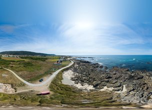
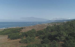
The Natural Monument of Alcantilado de Montedor has approximately 55ha, bounded to the north by the Forte do Paçô and to the south by the Praia da Câmboa do Marinheiro.
Coordinates
Lat: 41.7456112
Long: -8.878909
 Theme
Theme
 Point of interest


Themes
Discover all the themes of Cemetery of Ancient beaches of Alcantilado de Montedor
A STAIRCASE OF GIANTS
A HANGING BEACH
MILLENNIAL FOSSILIZED DUNES
UNDERGROUND MAGMA TONGUE
ROCK MURALS
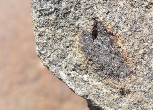
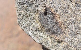
Thermometers and Barometers | Garnet
Ancestral Beaches | Coastal Platforms I, II, III and IV
Bouça de Frade Fault
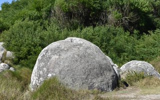
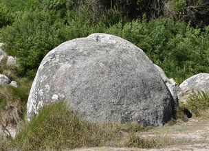
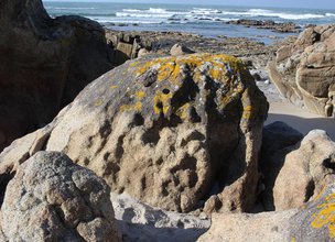
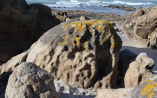
Rounded Boulders
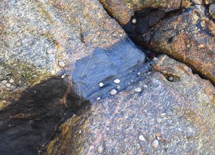
Circulating magmatic fluids | Tourmalinite
Ancestral Beach | 124 thousand years
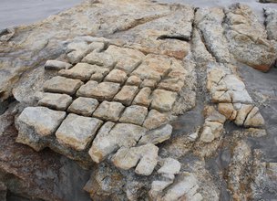
Granitic Models | Split block
Granitic Models | Alveoli of contact
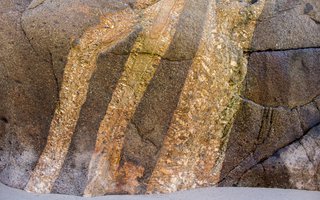
Magma Circulation | Fluidalities
Magma circulation | Enclaves
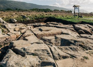
Granitic model | Corrugated pavements
Granitic model | Slopes Evolution
Salt Pans
Ancestral Dunar Field
Ancestral Beach | 235 thousand years
Granitic Models | Potholes and Tafoni
Ancestral Beach | 330 thousand years
Ancestral Beach | 410 thousand years
Migmatites of Montedor | 290 million years
Morgado fishing ground

Ecological Recovery
The following proposal was presented by the Mayor of the Chamber:- "PROPOSAL - Cooperation Protocol within the scope of the Progama de Reabilitação de Áreas Classificadas do concelho de Viana do Castelo - Responsabilidade ambiental no âmbito das áreas classificadas do concelho de Viana do Castelo".
In the scope of the Municipal Strategy for Nature Conservation, a plan inscribed in the ongoing Environment and Biodiversity Agenda for the four-year period 2017-2021, the Municipality prepared the Programa de Reabilitação Ecológica das Áreas Classificadas do concelho, in this first phase, focusing on 5 of the 13 Natural Monuments, unique areas for the knowledge of the geological history of the Iberian Peninsula since more than 500 million years ago and which are part of the application that the Municipality is preparing for recognition as a UNESCO World Geopark territory. Viana do Castelo is a rich territory from the point of view of Natural and Cultural Heritage, with about 4,800 hectares specifically designated for the protection of fauna and flora habitats (3 sites of Community importance of Natura 2000 Network), being the only municipality in the country with the geological heritage inventory concluded and duly classified with 13 natural monuments, making up a total area of about 2,832 hectares. The recovery programme that was drawn up supported an application to PO SEUR, with approval of the overall investment amount of 500,000 euros, financed at 85%, with implementation in 2020 and 2021. The ecological recovery interventions that are intended to be carried out include actions to eradicate and control exotic species, mainly Acacia dealbata (Mimosa), Acacia longifolia (Acacia longifolia) and Acacia Melanoxylon (Australia), Carpobrotus edulis (beach weevil), Arundo donax (giant reed), Trandescantia fluminencis (Fortune grass or tradescância) and Cortaderia selloana (pampas grass or plumas). In addition to these actions, supported by an exhaustive inventory carried out by the Municipality for those species, the programme includes actions to promote scientific literacy to the population and the densification of the Municipality's Citizen Science strategy, extending the Bioregisto platform to the cartography of invasive vegetation, in collaboration with the Functional Ecology Centre of the University of Coimbra (invasoras.pt). In addition, planting actions are planned in the areas to be ecologically intervened, namely native species such as oak, pine, hawthorn, holm oak, birch or heather, among others, within the scope of the Municipal Year for the Recovery of Portuguese Native Forests, currently underway. In order to guarantee the perennial success of the intervention and the investment made, the rehabilitation programme foresees the involvement of the social and business fabric, and within the scope of the environmental responsibility of the institutions, so that they may take responsibility for the maintenance of the ecological quality of all or parts of the classified areas of the municipality of Viana do Castelo. The programme for the ecological rehabilitation of the classified areas of Viana do Castelo - 1st phase - was carried out with the collaboration of the Parish Councils of Afife, Carreço, Darque, Vila Nova de Anha and Santa Marta de Portuzelo, and also with the Parish Councils of Mazaferes and Vila Fria and the Parish Councils of Viana do Castelo (Santa Maria Maior and Monserrate) and Meadela. The Associação de Caçadores de Vila Nova de Anha and the Comissão Diretiva dos Baldios da Montaria were also partners.


Hello little one!
I'm Piquinhos and I can help you learn more about the Geopark!

Technical details
Cemetery of Ancient beaches of Alcantilado de Montedor
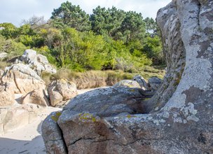
The combination of the erosion of the Rheic rocks, which surrounded the consolidated magmatic chambers (plutonites), with the survey processes that the territory has been subjected to since the end of the Mesozoic era (alpine orogeny), revealed the Paleozoic depths of this territory to the surface. The effects of heating and space conquest of plutonites on the rocks of the Rheic, and the collision geometry of the Paleozoic supercontinents (oblique and diachronic collision - phases of varicose deformation - D1, D2 and D3) can be interpreted in geological aspects of great interest and beauty, such as carriages, folds or mineralogical paragenesis, which today we can contemplate, for example, in Montedor.
It is therefore the materials and structures of the Paleozoic heritage that control quaternary geology and geomorphology, through interaction with external geodynamic processes such as coastal processes or those resulting from climatic evolution.
In this context and in a large scale analysis, the existence of platforms molded in exhumed granite, allows us to know the altimetric position of 5 levels of old beaches (coastal platforms) preserved above the current beach (<1.8 m): Platform I (~ 18 m), Platform II (~ 13 m), Platform III (~ 8 m), Platform IV (4.5-5.5 m) and Platform V (2.0-3.5 m) (values nmm ).
Some of these platforms still retain remains of biological activity, such as sea urchin alveoli (ichnofossils) and other signs of beach dynamics, such as notches or fossilized dune fields. In other locations, where the Viana do Castelo massif is placed on the margin and allows the coastal platform to develop, the coastal platforms remain hidden under the muddy sand sediments that give it a flattened shape.
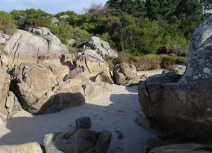
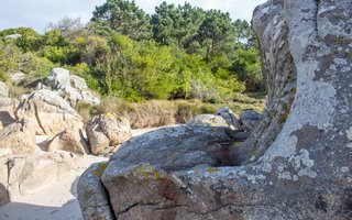
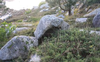
This monument is also special for us to understand how the slopes evolve and are dismantled, a process registered in residual geoforms such as tafoni, pans and exutories, grooves, pseudo-stratification, peduncles, wavy floors and exfoliation.
References and scientific articles
- Carvalhido, R. (2016). O livro da Pedra - monumentos naturais Locais de Viana do Castelo.
- Carvalhido, R. (2012). O Litoral Norte de Portugal (Minho-Neiva): evolução paleoambiental quaternária e proposta de conservação do património geomorfológico. Tese de Doutoramento. Universidade do Minho. 564p.
Child Mode
Discover the geopark in a simpler format, aimed at the little ones.
Clique ENTER para pesquisar ou ESC para sair