
Closing of the Rheic Ocean
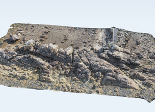
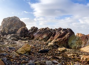
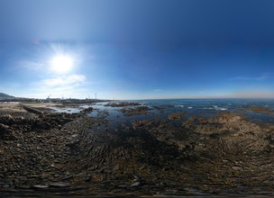
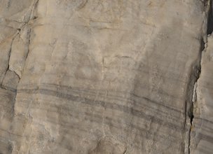
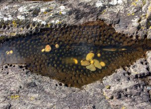
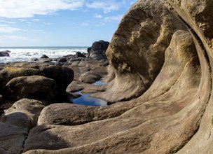
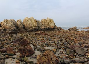
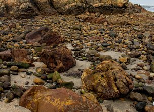
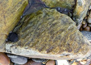
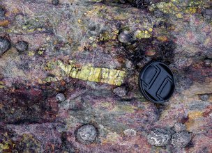
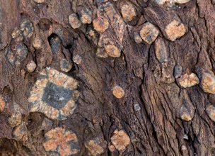
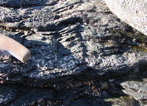
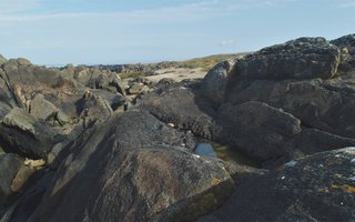
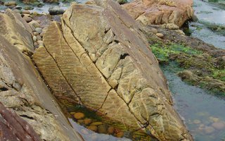
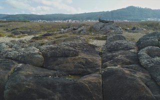
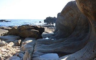
The Rheic Remains in Pedras Ruivas Local Natural Monument offers various geomorphological interests like the residual and tectonic, and others, like the periglacial, the paleontological, the geocultural, the mineralogical and ecological. This is a key location that preserves essential elements for the interpretation of Rheic’s hydrodynamic, namely the interpretation of sedimentary processes operating at the sandy-muddy bottom of this ancient ocean (ripplemarks and fossilized laminations) and the paleobiodiversity installed (ichnofossils of arenicola – Scholitus sp. and trilobites – Cruziana sp.) (Carvalhido, 2012).
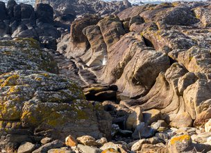
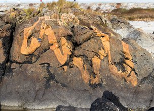
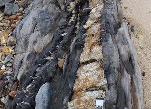
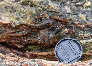
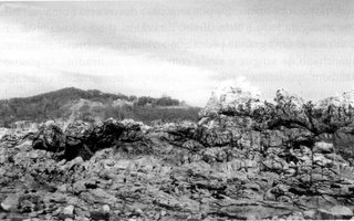
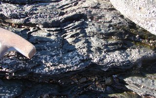
There are some remains related to the way that the Rheic’s closing was processed and evolved (cf. Alcantilado de Montedor Local Natural Monument) such as the overlap of various episodes regarding dominant tangential tectonics, specifically during the phases of hercynic deformation D1 & D3 (Pamplona et al., 2006). These events were responsible for the main geometrical aspects of the meta-sediments, like the domino and sigmoidal structure, and the quartzite folding of the St. Justa Fm. as well as kink foldings of the schists of the Valongo Fm. (sinistral strike-slip fault syn-D1). The dextral strike-slip fault syn-D3 was responsible for the late settlement of veins and dykes by local distention.
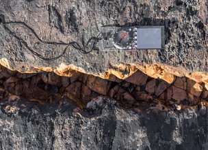
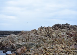
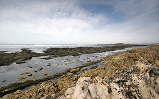
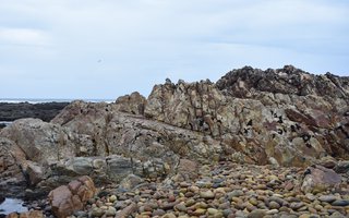
In this area there are structures that at the geological timescale, are really recent. Beyond the rock’s flattened tops, remains of pre-existing beaches from the last interglacial period (125 thousand years old), sediments of an ancient lake, which endured in this landscape during around 7 thousand years (from 18000 to 11000 years old), are preserved, filled by the spring fusion waters produced by the melting snow of local hillsides (Carvalhido, 2012).
References:
The Rheic Remains in Pedras Ruivas Local Natural Monument offers various geomorphological interests like the residual and tectonic, and others, like the periglacial, the paleontological, the geocultural, the mineralogical and ecological. This is a key location that preserves essential elements for the interpretation of Rheic’s hydrodynamic, namely the interpretation of sedimentary processes operating at the sandy-muddy bottom of this ancient ocean (ripplemarks and fossilized laminations) and the paleobiodiversity installed (ichnofossils of arenicola – Scholitus sp. and trilobites – Cruziana sp.) (Carvalhido, 2012).
There are some remains related to the way that the Rheic’s closing was processed and evolved (cf. Alcantilado de Montedor Local Natural Monument) such as the overlap of various episodes regarding dominant tangential tectonics, specifically during the phases of hercynic deformation D1 & D3 (Pamplona et al., 2006). These events were responsible for the main geometrical aspects of the meta-sediments, like the domino and sigmoidal structure, and the quartzite folding of the St. Justa Fm. as well as kink foldings of the schists of the Valongo Fm. (sinistral strike-slip fault syn-D1). The dextral strike-slip fault syn-D3 was responsible for the late settlement of veins and dykes by local distention.
In this area there are structures that at the geological timescale, are really recent. Beyond the rock’s flattened tops, remains of pre-existing beaches from the last interglacial period (125 thousand years old), sediments of an ancient lake, which endured in this landscape during around 7 thousand years (from 18000 to 11000 years old), are preserved, filled by the spring fusion waters produced by the melting snow of local hillsides (Carvalhido, 2012).
References:

Location
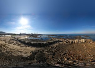
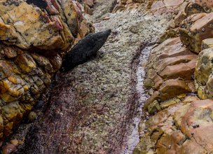
This place should be visited with some caution, because depending on the maritime conditions, the geosites may not be visible. Try to visit at low tide and with a calm sea.
Coordinates
Lat: 41.6947628
Long: -8.8500548
 Theme
Theme
 Point of interest
Themes
Discover all the themes of Rheic Remains in Pedras Ruivas
A 400 MILLION-YEAR-OLD ROCK OCEAN
THE RISES AND DESCENTS OF THE ATLANTIC
Pedras Ruivas
Stone Chains
Magmatic fluids | Pegmatite with spodumena
Low tide on the primitice Rheic Ocean
Shale Folds
The geology of Pedras Ruivas
Stone Dominoes
Ancestral Beach | 124 000 years
Current Beach
Ancestral Beach - Ichnofossils of Paracentrotus lividus
Ancestral Lagoon

Ecological Recovery
The following proposal was presented by the Mayor of the Chamber:- "PROPOSAL - Cooperation Protocol within the scope of the Progama de Reabilitação de Áreas Classificadas do concelho de Viana do Castelo - Responsabilidade ambiental no âmbito das áreas classificadas do concelho de Viana do Castelo".
In the scope of the Municipal Strategy for Nature Conservation, a plan inscribed in the ongoing Environment and Biodiversity Agenda for the four-year period 2017-2021, the Municipality prepared the Programa de Reabilitação Ecológica das Áreas Classificadas do concelho, in this first phase, focusing on 5 of the 13 Natural Monuments, unique areas for the knowledge of the geological history of the Iberian Peninsula since more than 500 million years ago and which are part of the application that the Municipality is preparing for recognition as a UNESCO World Geopark territory. Viana do Castelo is a rich territory from the point of view of Natural and Cultural Heritage, with about 4,800 hectares specifically designated for the protection of fauna and flora habitats (3 sites of Community importance of Natura 2000 Network), being the only municipality in the country with the geological heritage inventory concluded and duly classified with 13 natural monuments, making up a total area of about 2,832 hectares. The recovery programme that was drawn up supported an application to PO SEUR, with approval of the overall investment amount of 500,000 euros, financed at 85%, with implementation in 2020 and 2021. The ecological recovery interventions that are intended to be carried out include actions to eradicate and control exotic species, mainly Acacia dealbata (Mimosa), Acacia longifolia (Acacia longifolia) and Acacia Melanoxylon (Australia), Carpobrotus edulis (beach weevil), Arundo donax (giant reed), Trandescantia fluminencis (Fortune grass or tradescância) and Cortaderia selloana (pampas grass or plumas). In addition to these actions, supported by an exhaustive inventory carried out by the Municipality for those species, the programme includes actions to promote scientific literacy to the population and the densification of the Municipality's Citizen Science strategy, extending the Bioregisto platform to the cartography of invasive vegetation, in collaboration with the Functional Ecology Centre of the University of Coimbra (invasoras.pt). In addition, planting actions are planned in the areas to be ecologically intervened, namely native species such as oak, pine, hawthorn, holm oak, birch or heather, among others, within the scope of the Municipal Year for the Recovery of Portuguese Native Forests, currently underway. In order to guarantee the perennial success of the intervention and the investment made, the rehabilitation programme foresees the involvement of the social and business fabric, and within the scope of the environmental responsibility of the institutions, so that they may take responsibility for the maintenance of the ecological quality of all or parts of the classified areas of the municipality of Viana do Castelo. The programme for the ecological rehabilitation of the classified areas of Viana do Castelo - 1st phase - was carried out with the collaboration of the Parish Councils of Afife, Carreço, Darque, Vila Nova de Anha and Santa Marta de Portuzelo, and also with the Parish Councils of Mazaferes and Vila Fria and the Parish Councils of Viana do Castelo (Santa Maria Maior and Monserrate) and Meadela. The Associação de Caçadores de Vila Nova de Anha and the Comissão Diretiva dos Baldios da Montaria were also partners.

Hello little one!
I'm Piquinhos and I can help you learn more about the Geopark!

Technical details
The Iberian Peninsula is part of the internal range of the Varisca Chain that extends for more than 3000 km, from Morocco to the north of Bohemia. It resulted from the approach and collision (starting in the Middle Devonic) of the NW portion of Gondwana (current African territory) and Laurentia - Baltica, separated by Tethis, and whose closing position corresponds to the suture zone marked by the Porto-Tomar shear. The survey of the Varisca Chain took more than 70 million years, having a polyphasic and zonal character depending on the characteristics of the approximation vector of the two supercontinents involved in the structures of the Iberian Massif, allowing the definition of several geotectonic zones based on the different paleogeographic, tectonic, metamorphic and magmatic characteristics, evidenced for each sector (Matte & Ribeiro, 1975; Dias & Ribeiro, 1995). Tectogenesis was accompanied by regional metamorphism and magmatism, which mainly affected internal areas.
Accordingly to Carvalhido (2012, 2014a,b,c) the knowledge of sea level changes is essential for understanding the quaternary evolution of sedimentation environments, since these disturbances influence the characteristics of the processes that determine the supply and distribution of particles.
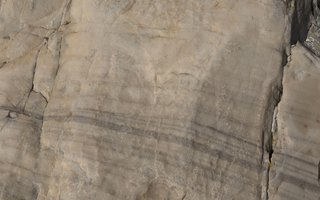
The Darque Surface has several types of continental and transition environments sediments, which document paleoenvironmental conditions that varied between MIS9 (340ka) and MIS1 (present).
Sedimentary units identified in this natural monument reproduce evidence of the environments at your deposition:
The Cambôa do Marinheiro silts, dated below 20 ka and up to about 13 ka (most recent date obtained) (MIS2), show that sedimentary processes have become essentially dependent on drainage in conditions of greater water scarcity, which indicate the progression and peak of the installation of the cold conditions resulting from the last glaciation. The conditions of diffuse drainage will have contributed to the formation of lacustrine bodies of high confinement, of swampy character, installed in shallow depressions of the Coastal Platform.
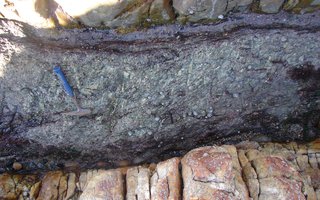
The Conglomerates and Sands of Rego de Fontes correspond to the installation of depositional means with some variability of facies, with dating <13 ka (MIS2 / 1). In general, the character of episodic water availability is observed, namely represented in drainage under low granoselective regimes, sometimes torrential (grain-flow to debrisflow), evolving to facies associated with soaked soils responsible for solifluxive processes.
References:
Carvalhido, Ricardo (2012). O Litoral Norte de Portugal (Minho-Neiva): evolução paleoambiental quaternária e proposta de conservação do património geomorfológico. Universidade do Minho.
Carvalhido, R.; Pereira, D. & Cunha, P. (2014a). Depósitos costeiros quaternários do noroeste de Portugal (Minho - Neiva): caracterização datação e interpretação paleoambiental. Comunicações Geológicas (2014) 101, Especial II, 605–609.
Carvalhido, R.; Brilha, J. & Pereira, D. (2014b). Monumentos Naturais Locais de Viana do Castelo: processo de classificação e estratégias de valorização. Comunicações Geológicas (2014) 101, Especial III, 1219–1223.
Carvalhido, R.; Pereira, D; Cunha, P.; Buylaert, J. & Murray, A. (2014c). Characterization and dating of coastal deposits of NW Portugal (Minho-Neiva area): a record of climate, eustasy and crustal uplift during the Quaternary. Quat Int, 328-329: 94–106
Matte & Ribeiro, A. (1975). Forme et orientation de l'ellipsoïde de déformation dans la virgation hercyenne de Galice. Relations avec le plissement et hypothèses sur la genèse de l'árc ibéro-armoricain. C. R. Acad. Sc. Paris, 280.
Dias, R. & Ribeiro, A. (1995). The Ibero-Armorican Arc: A collision effect against an irregular continent? Tectonophysics, 246,113-128.
Child Mode
Discover the geopark in a simpler format, aimed at the little ones.
Clique ENTER para pesquisar ou ESC para sair